Routes from Saas Fee
The following are just some ideas for walks in the Alps.
Some of this is from research from the web - the rest is just a summary of the details you can find in the guide books.
I'm unsure of the timings quoted, so wouldn't rely on them too much at this stage.
I've tried to nick relevant pictures off the web.
I'm not suggesting we'd do all of these routes, they're just ideas for some of the things we could do.
Day Routes
Longer Routes
1. Saas Fee to Mittaghorn
 This is described as a "fairly stiff walk".
The Mittaghorn is south west of Saas Fee.
From Chalbermatten (1798m) just out of town get the cable car to Plattjen station (2570m).
Take the route marked for the Britannia hut.
At the path to the right ascend up a straight-forward and well defined path scrambling to the top of the Mittaghorn (3143m).
Described as taking 3 hrs from Plattjen at 2km and 589m ascent it should be possible to do in 2hrs back?
The view is supposed to be fantastic because you look up to the big hills & down to the valleys.
You can follow the ridge from the Mittaghorn to Egginer (3366m) 1.22km away and an extra 250m ascent (another 2hrs), but this includes a "fairly difficult" bit of rock climbing?
This is described as a "fairly stiff walk".
The Mittaghorn is south west of Saas Fee.
From Chalbermatten (1798m) just out of town get the cable car to Plattjen station (2570m).
Take the route marked for the Britannia hut.
At the path to the right ascend up a straight-forward and well defined path scrambling to the top of the Mittaghorn (3143m).
Described as taking 3 hrs from Plattjen at 2km and 589m ascent it should be possible to do in 2hrs back?
The view is supposed to be fantastic because you look up to the big hills & down to the valleys.
You can follow the ridge from the Mittaghorn to Egginer (3366m) 1.22km away and an extra 250m ascent (another 2hrs), but this includes a "fairly difficult" bit of rock climbing?
2. Saas Fee to Mischabel hut / Mallig
 The Mishcabel Hut (3335m) is west of Saas Fee.
You first take the cable car to the Hannig station (2336m).
There's a circular walk from Hannig which loops back to Saas Fee via Mallig (2700m) - about 9km, 500m ascent and 900m descent in 3hrs?
The Mischabelhutte is one of the starting points for tackling the Dom (4545m) - but I doubt we'll be doing that!
On the web someone describes the path up as a boring walk whereas somewhere else it's describes as scary!
There are a large number of switch backs - so it must be quite steep.
At 3.5km and 1000m ascent, it might take 3.5 hrs to walk up and at least a 2 hrs to walk down?
The Mishcabel Hut (3335m) is west of Saas Fee.
You first take the cable car to the Hannig station (2336m).
There's a circular walk from Hannig which loops back to Saas Fee via Mallig (2700m) - about 9km, 500m ascent and 900m descent in 3hrs?
The Mischabelhutte is one of the starting points for tackling the Dom (4545m) - but I doubt we'll be doing that!
On the web someone describes the path up as a boring walk whereas somewhere else it's describes as scary!
There are a large number of switch backs - so it must be quite steep.
At 3.5km and 1000m ascent, it might take 3.5 hrs to walk up and at least a 2 hrs to walk down?
3. Mischabel hut to Ulrichshorn (and Nadelhorn?)
 We could just stay at the Mischabelhutte for a nights acclimatization or the next morning ascend to the Windjoch (3850m, 500m ascent in 2km) from where it is a short walk to the Ulrichshorn (3925m - "fantastic viewpoint").
Also not far away is the Nadelhorn (4327m).
This is a 1.2km and 450m ascent from the Windjoch, and it sounds like it might be within our capabilities?
We could just stay at the Mischabelhutte for a nights acclimatization or the next morning ascend to the Windjoch (3850m, 500m ascent in 2km) from where it is a short walk to the Ulrichshorn (3925m - "fantastic viewpoint").
Also not far away is the Nadelhorn (4327m).
This is a 1.2km and 450m ascent from the Windjoch, and it sounds like it might be within our capabilities?
4. Saas Fee to Britannia hut
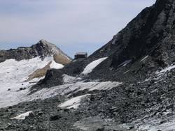 There are two ways to get to the Britannia hut (3030m).
- Following the same route described for ascending the Mittaghorn from Plattjen station, but keep going over the Egginerjoch (2989m). It's 5km to the hut from Plattjen, 500m ascent taking more than 2hrs?
- The easier route is to get the cable car all the way to Felskinn (2989m) changing midway at Maste (2572m)? It's then a short 2km walk to the hut with only 100m of ascent.
The route from Felskinn is via the Chessjen glacier as is the last part of the route from Plattjen, but it's a well trodden route so shouldn't pose any difficulties. We could spend a night in the hut before climbing the Allalinhorn (4027m)
5. Allalinhorn from Brittannia hut to Mittel Allalin
 Alalinhorn (4027m) is one of the easy 4000 meter peaks in the Alps.
The classic East Ridge via Hohlaubgrat is the most popular route from the Britannia Hut.
It's nearly 4km to the summit ascending more than 1050m which should be doable in 4hrs?
You descend from the summit via the North West ridge to catch the Metro-Alpin from the Mittel Allalin station (3457m).
From Mittel Allalin to the Allalinhorn summit it's only about 2.5km with 500m ascent taking 2hrs - so this would be an easier option.
There are crevasses on the route, so even though it is an "easy" climb we need to be aware that it is still dangerous climbing.
Alalinhorn (4027m) is one of the easy 4000 meter peaks in the Alps.
The classic East Ridge via Hohlaubgrat is the most popular route from the Britannia Hut.
It's nearly 4km to the summit ascending more than 1050m which should be doable in 4hrs?
You descend from the summit via the North West ridge to catch the Metro-Alpin from the Mittel Allalin station (3457m).
From Mittel Allalin to the Allalinhorn summit it's only about 2.5km with 500m ascent taking 2hrs - so this would be an easier option.
There are crevasses on the route, so even though it is an "easy" climb we need to be aware that it is still dangerous climbing.
6. Alphubel from Langflue to Mittel Allalin
 The Alphubel (4206m) may be something we'd need a guide for?
It's a grade PD difficulty with crevassed areas to be crossed and a 50m "mixed passage" II climb to the Feechopf (3888m).
The suggested route is to hut overnight at the Langflue (2869m) to ensure an early start, then follow a winding route up to the Alphubel - 1350m ascent, around 5km in 5hrs.
The suggested descent is to the Mittel Allalin (3457m). We'd retrace our steps for some way before descending south to the Alphubeljoch (3772m), before ascending another 100m to the Feechopf. It's a steep descent to the Feejoch where we'd meet the route Brittanniahutte-Allalinhorn route before descending to the Mittel Allalin to catch the tunnel railway and cableway back to Saas Fee.
It's 880m of descent, 130m ascent - about 5km in 3hrs from the summit.
The Alphubel (4206m) may be something we'd need a guide for?
It's a grade PD difficulty with crevassed areas to be crossed and a 50m "mixed passage" II climb to the Feechopf (3888m).
The suggested route is to hut overnight at the Langflue (2869m) to ensure an early start, then follow a winding route up to the Alphubel - 1350m ascent, around 5km in 5hrs.
The suggested descent is to the Mittel Allalin (3457m). We'd retrace our steps for some way before descending south to the Alphubeljoch (3772m), before ascending another 100m to the Feechopf. It's a steep descent to the Feejoch where we'd meet the route Brittanniahutte-Allalinhorn route before descending to the Mittel Allalin to catch the tunnel railway and cableway back to Saas Fee.
It's 880m of descent, 130m ascent - about 5km in 3hrs from the summit.
7. Alphubel from Tasch hut to Mittel Allalin
 Evidentially it's also possible to ascend the Alphubel from the Taschhutte (2701m) via the Alphubeljoch - and this avoids some of the worst areas of crevasse, but you get to this hut from the Zermatt side.
I guess the easier descent is again via Mittel Allalin.
Evidentially it's also possible to ascend the Alphubel from the Taschhutte (2701m) via the Alphubeljoch - and this avoids some of the worst areas of crevasse, but you get to this hut from the Zermatt side.
I guess the easier descent is again via Mittel Allalin.
8. Weissmies from Hohsaas and back
 The normal route up the Weissmies (4023m) is via the NW face and west ridge starting from Hohsaas (3101m) cableway.
There's a hut at Hohsaas which is closest to the mountain allowing an early start - or else the Weissmies huts (2726m) are at about 1hr, (2km, 400m ascent) further away.
There's usually a worn track that guides you through the crevasse danger.
It's 1000m ascent in 3km taking 4hrs to the summit from Hohsaas.
The normal route up the Weissmies (4023m) is via the NW face and west ridge starting from Hohsaas (3101m) cableway.
There's a hut at Hohsaas which is closest to the mountain allowing an early start - or else the Weissmies huts (2726m) are at about 1hr, (2km, 400m ascent) further away.
There's usually a worn track that guides you through the crevasse danger.
It's 1000m ascent in 3km taking 4hrs to the summit from Hohsaas.
9. Weissmies from Almageller to Hohsaas
 The guide book suggests that the SE ridge is slightly easier with less glacier work and exposure - even though it doesn't look like it on the map!
But this might be an interesting option from the Almageller hut (2860m), where it's 1125m ascent and 3km - the guide book says it takes 7-8hrs.
To get the Almageller hut from Saas Almagell the day before you have to walk all the way which is 1180m of ascent.
I guess if we were to climb Weissmies this way, we'd want to descend down via Hohsaas?
The guide book suggests that the SE ridge is slightly easier with less glacier work and exposure - even though it doesn't look like it on the map!
But this might be an interesting option from the Almageller hut (2860m), where it's 1125m ascent and 3km - the guide book says it takes 7-8hrs.
To get the Almageller hut from Saas Almagell the day before you have to walk all the way which is 1180m of ascent.
I guess if we were to climb Weissmies this way, we'd want to descend down via Hohsaas?
10. Jegihorn from Saas Grund
 There seems to be scope for a day walk in the area near the Wiessmies huts.
We could get the cable car from Saas Grund to Kreuzboden (2400m) and walk up the Jegihorn (3206m) - 800m ascent, 3km in 3hrs.
Or this could be done the day before ascending the Weissmies?
There seems to be scope for a day walk in the area near the Wiessmies huts.
We could get the cable car from Saas Grund to Kreuzboden (2400m) and walk up the Jegihorn (3206m) - 800m ascent, 3km in 3hrs.
Or this could be done the day before ascending the Weissmies?
11. Lagginhorn from Wiessmies Hut
 Mostly a rocky mountain, the Lagginhorn (4010m) ascent is described as involving easy rock climbing and scrambling on good rock.
We'd start from the Wiessmies hut and ascend up the Lagginhorn glacier before ascending the ridge to the summit.
Crevasse on the glacier can be avoided by following the ridge all the way - but this requires a bit more climbing?
It's 1200m ascent to the summit, 3km in 5hrs. The only option is to return the way you came.
Mostly a rocky mountain, the Lagginhorn (4010m) ascent is described as involving easy rock climbing and scrambling on good rock.
We'd start from the Wiessmies hut and ascend up the Lagginhorn glacier before ascending the ridge to the summit.
Crevasse on the glacier can be avoided by following the ridge all the way - but this requires a bit more climbing?
It's 1200m ascent to the summit, 3km in 5hrs. The only option is to return the way you came.
12. Breithorn from Klein Matterhorn
 The Breithorn (4164m) is described as very crowded because of the ease of access - it's the easiest of the 4000'ers.
The closest hut is Gandegg hut (3029m), but the most likely option is to start from the valley bottom in Zermatt (1600m).
Starting from the Klein Matterhorn (3883m) mountain station we'd descend to a saddle (3796m) then to the Breithorn pass (3824m) from where we climb more or less straight to the summit following the ridge somewhat.
It's 375m ascent, 3.5km in 2hrs.
The Breithorn (4164m) is described as very crowded because of the ease of access - it's the easiest of the 4000'ers.
The closest hut is Gandegg hut (3029m), but the most likely option is to start from the valley bottom in Zermatt (1600m).
Starting from the Klein Matterhorn (3883m) mountain station we'd descend to a saddle (3796m) then to the Breithorn pass (3824m) from where we climb more or less straight to the summit following the ridge somewhat.
It's 375m ascent, 3.5km in 2hrs.
 The guide book describes ascending the Breithorn Central (4159m) from the col (4076m) east of the main summit - although it looks like it should be possible to follow the ridge west to east (or vice-versa)?
Another possibility is Breithorn Twin (4139m) which is further east and is ascended from below the rock buttress of Breithorn Central.
Described as a short spectacular ascent that's mainly snow but craggy at the end.
13. Pollux (and/or Castor?) from Klein Matterhorn
 Pollux (4092m) is climbed from Klein Matterhorn cableway. As we'd be starting so high we'd need to ensure we were well acclimatized.
Walking below the Breithorn ridge we'd pass the Rosso Bivouac (3787m) and below the SW rock spur of Pollux to the Zwillingsjoch (3845m, 2-3hrs to this point) before climbing the SE ridge to the summit.
We'd have ascended 700m in 6km taking 4hrs.
From Zwillingsjoch it seems obvious the Castor (4228m) is a possibility.
It would require a further 400m climb taking at least 2hrs.
But it's probably too far to allow a return to Klein Matterhorn in reasonable snow conditions?
Pollux (4092m) is climbed from Klein Matterhorn cableway. As we'd be starting so high we'd need to ensure we were well acclimatized.
Walking below the Breithorn ridge we'd pass the Rosso Bivouac (3787m) and below the SW rock spur of Pollux to the Zwillingsjoch (3845m, 2-3hrs to this point) before climbing the SE ridge to the summit.
We'd have ascended 700m in 6km taking 4hrs.
From Zwillingsjoch it seems obvious the Castor (4228m) is a possibility.
It would require a further 400m climb taking at least 2hrs.
But it's probably too far to allow a return to Klein Matterhorn in reasonable snow conditions?


